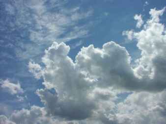
NubiScope determines cloud coverages and cloud base temperatures with high spatial and time resolution
The transmission of energy from sun to earth and earth into space is highly influenced by the complex processes in the atmosphere. Depending on thickness, clouds reflect 40 to 80 percent of solar radiation into space. Terrestrial radiation is significantly absorbed by clouds. The consistency and amount of cloud coverage has great influence on the weather situation.
The temperature range on earth depends on cloud coverage as well as the evaporation and the diffusion of atmospheric pollutants. Photochemical processes in the lower atmosphere, like production of ozone, are also controlled by clouds.
Although knowledge of the current cloud coverage is crucial to forecast the weather, up to now there were still no devices collecting sufficient data.
The traditional method using human observers is expensive, limited by night and the results differ from observer to observer.
Commercially available IR-cameras equipped with fisheye are limited in temperature range so that their use is restricted to certain weather situations and areas.
Ceilometers measure only one point at a time and are therefore of limited use for that purpose.
Our new IR-measuring system (NubiScope) puts an end to all these limitations. It produces precise and continuous data for any layer 24 hours a day.
NubiScope can serve as an invaluable addition to enhancing the interpretation of IR-satellite images: Cloud coverage in small patterns can be clearly differentiated by our device, and snow covered soil does not touch its effectivity in the least. Even cirrus-coverage without gaps becomes transparent for the satellite if combined with NubiScope. The combination of NubiScope-data with satellite-data delivers seamless three-dimensional information about the actual cloud coverage.
The instrument
NubiScope is completely independent and constructed as a stand alone unit. It comes with automatic heating to endure working in winter or cold regions.
The system is fully computer controlled. An IR-Sensor (Pyrometer) is mounted onto a rotating pan & tilt unit. A precipitation gauge indicates rain or snow.
NubiScope continuously scans the sky day and night and runs specifically designed algorithms to produce the desired data. Communication to a host computer is managed via serial interface allowing remote access to the system at any time.
Determination of cloud coverage
Scanning clouds in the sky generally shows significant temperature differences according to the height of the layer measured. Higher clouds principally show lower temperatures. The lowest temperature is measured in cloudless sky.
In each layer the temperature increases from zenith to horizon. This "horizon-effect" is most noticeable in cloudless sky and nearly unnoticeable in low clouds. To obtain the correct relation of temperature to height we use our specifically designed algorithms to correct the data according to height, azimuth angle and weather situation. Thus the problem of processing data for the overall sky has been solved.
The condition of the sky is classified in different states: Clear sky, Cirrus, Broken Clouds, Overcast or Fog are detected by an algorithm distributing the temperatures.
Summary
Features of NubiScope are:- Continuous, reliable and realistic scans of the sky
- Fully automated scanning and data acquisition
- Determination of cloud coverages of cloud layers with high spatial and time resolution, day and night
- Determination of main cloud base height
- Recording of dynamic changes of the cloud cover with high reproducibility
- Detection of potential inflight icing conditions
- Secure use at low temperatures due to automatic heating
- Data communication and remote access by telephone modem
- System maintained by Watchdog, detailed error log
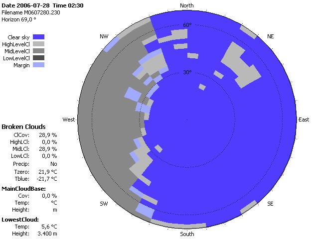
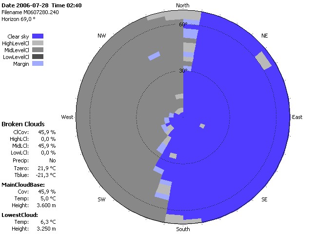
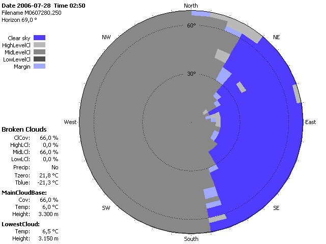
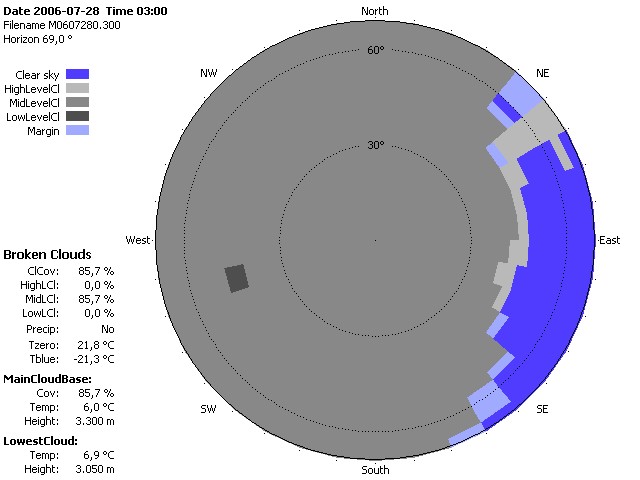
The power of our algorithms is demonstrated by the following sequence of scans, all taken at the same location.
Figure one to four (2006/28/07 at 2:30 / 3:00 hour UTC):